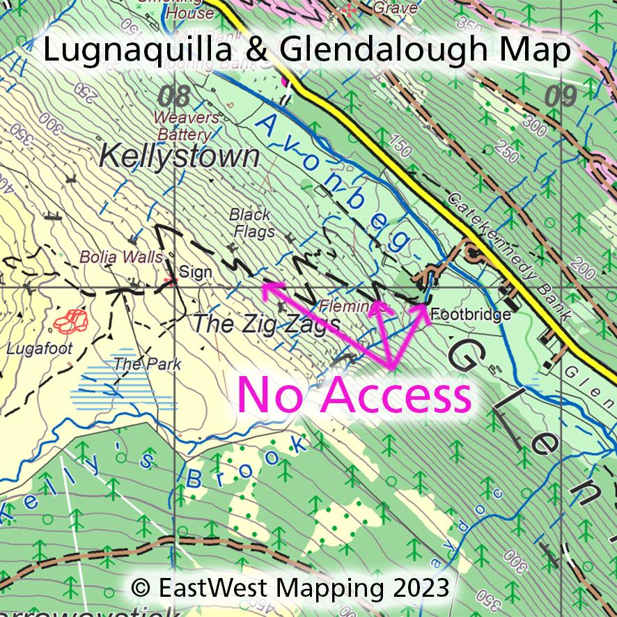
Lugnaquilla & Glendalough Map Update
The Zig Zags. Following the recent despicable assault in Glenmalure, Co.Wicklow – please disregard the agreed access route symbol currently marked on our Lugnaquilla & Glendalough print map and Wicklow digital maps.
Please use alternative ways that are well mapped on our maps via Drumgoff, Clonakeen and Barravore.
We wish Pat and family well and thank him for all the help and work he has put in to foster public access to the hills. We are also grateful to Pat and his neighbours for all the information on local placenames and heritage that they have shared and which is printed on this mapping.
Access to the Irish countryside is very much based on mutual respect and care between local residents and recreational users. Please respect all local signage.
#eastwestmapping #visitwicklow #wicklowmountains #countywicklowpartnership